
|
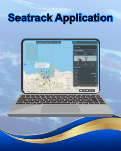
Seatrack Application Seatrack is an advanced integrated solution for maritime monitoring, Providing advanced web-based tracking and monitoring technology. The application enables real-time vessel tracking and provides easy access to critical data such as weather conditions, sea currents, and maritime traffic information. Additionally, Seatrack offers detailed vessel information, including ship type, speed, direction, and operational status, which is crucial for fleet management and voyage planning. With its user-friendly interface, Seatrack simplifies fleet management, aiding in faster and more accurate decision-making, while enhancing safety and operational efficiency in the maritime sector. |
|
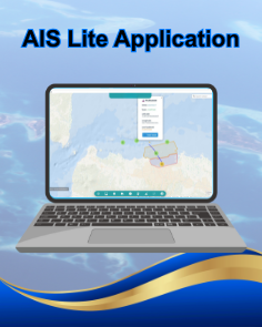
AIS Lite Application AIS Lite is an advanced integrated solution for maritime monitoring, providing comprehensive tracking and monitoring technology. This application enables real-time vessel tracking, providing valuable data such as vessel position, speed, and direction, as well as weather and maritime traffic conditions. AIS Lite is a desktop application designed to provide an easy-to-use interface, allowing users to efficiently access and analyze maritime data. In addition, this application can be accessed locally and online, providing flexibility for users to monitor ships and obtain important information anytime, anywhere. With these advanced features, AIS Lite helps improve safety and can display ship tracking more effectively. |
|
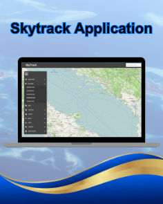
Skytrack Application Skytrack is an advanced integrated solution for maritime and GPS monitoring, providing more advanced, web-based tracking and monitoring technology. Using Skytrack, users can track ships in real time and access important information about their position, speed, direction, and weather conditions. In addition, Skytrack also provides more complete and detailed supporting data, such as information about ports, port contacts, and other maritime infrastructure. This allows users to obtain a comprehensive overview of the situation at sea, facilitating fleet management and supporting more efficient and safer operational decisions. This technology also provides users with greater flexibility to monitor and manage maritime operations anytime and anywhere online. |
|
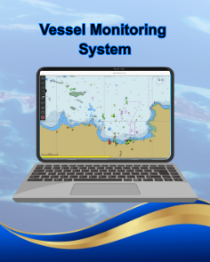
Vessel Monitoring System The Vessel Monitoring System (VMS) is maritime monitoring software provided in the AIS system purchase package. This application enables real-time vessel tracking, with the main feature being the display of vessel positions. VMS supports data integration from the AIS system to provide accurate information about the fleet, enabling remote monitoring. In addition, this application is also equipped with features such as sea depth monitoring, identification of coral reef locations, and other dangerous areas at sea, which help users avoid potential hazards. This application can be accessed locally and online, providing flexibility in managing maritime operations anytime and anywhere. |
|
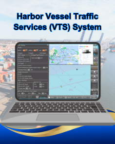
Harbor Vessel Traffic Services (VTS) System The company requires the rental of a maritime traffic monitoring system or vessel traffic service (VTS) system to monitor vessel movements in real time and provide historical vessel tracking data according to the company’s needs. This VTS system consists of radar, VHF radiotelephony, and Automatic Identification System (AIS). The purpose of the VTS system is to facilitate the safe and efficient movement of fast interceptor craft (FIC) in monitoring vessel traffic to prevent congestion and dangerous situations that are particularly relevant during times of high traffic density, such as collisions, dredging, anchoring, floating, and others that may pose a potential danger to subsea pipelines. |
|
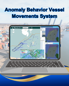
Anomaly Behavior Vessel Movements A system that monitors ship movements in real time, involving various agencies and ship owners. This system uses various data sources to independently track ships, provide comprehensive monitoring, and analyze ship behavior based on supporting data to detect anomalies or deviations in ship movements. This analysis aims to draw conclusions regarding abnormal patterns in ship movements that may indicate potential problems or suspicious activities. |

|
Early Warning Hydro Monitoring System Solutions
The early warning hydro monitoring system is a monitroting system designed to provide early warnings for potential water-related hazard or disasters, such as floods, tsunamis, or other threats related to hydrological conditions. |
|
Integrated Satellite Communication and Navigation System
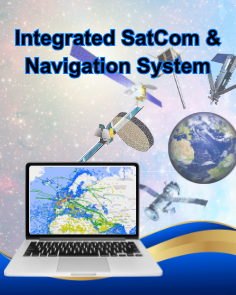
Iridium, Thuraya, Inmarsat, Beidou and AIS data combining the functions of all integrated data offers data analysis of tracking location coordinates, target information and efficient data acquisition in a wide range of maritime operations. |
|
Harbor Radio Frequency Monitoring and Direction Finder System
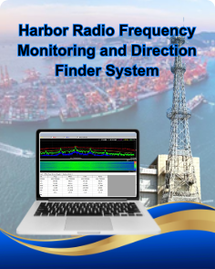
System used to monitor radio communications in and around the harbor. This system is also equipped with devices that can determine the direction of radio signals, such as communication between ships or port equipment. By using radio monitoring technology and direction finding techniques, this system helps to identify ships or equipment that are communicating or operating around the harbor. |
Innovative Maritime Hardware Solutions
|
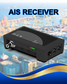
AIS Receiver Devices that receive signals from the Automatic Identification System (AIS) transmitted by other ships are essential tools in maritime monitoring. AIS is a transponder-based communication system that allows ships to automatically exchange information, such as position, speed, and direction. With this device, ships can obtain the data necessary to improve navigation safety, avoid collisions, and monitor ship positions in real time. The information received from the AIS system is also used for vessel traffic mapping, as well as to support other monitoring applications and systems used by maritime authorities and port managers to ensure efficient and safe management of waters. |
|
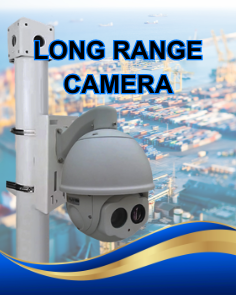
Long Range Camera CCTV cameras designed to monitor areas from a great distance, using high-performance sensors and infrared imaging to maintain clear recordings in low-light or night-time conditions. These long-range cameras are ideal for securing wide outdoor areas such as ports, coastlines, warehouses, and critical infrastructure, enabling operators to detect movement, identify potential threats, and track activity in real time. By combining optical zoom, advanced image processing, and reliable connectivity, they support better situational awareness and faster response to security incidents. |
|
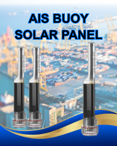
AIS Buoy Solar Panel An AIS buoy equipped with a solar panel is a self-powered navigation and monitoring device that transmits its position and status via the Automatic Identification System (AIS). The integrated solar panel continuously charges the internal battery, allowing the buoy to operate reliably in remote offshore locations without external power. This makes it ideal for marking shipping lanes, danger zones, anchorages, or work areas at sea, while providing real-time position, identification, and status information to nearby vessels and coastal monitoring stations. |
|
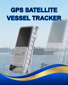
GPS Satellite Vessel Tracker GPS Satellite Vessel Tracker is a modern solution to address challenges in the shipping industry. Utilizing GPS and VMS (Vessel Monitoring System) technology, this device enables real-time monitoring of vessel positions, improves safety through automatic location reporting, supports operational efficiency through optimal route planning and fuel management, and ensures compliance with maritime regulations. |
Contact Us

XCILON FZCO
Dubai Silicon Oasis, DDP, Building A2,
Dubai, United Arab Emirates
E-mail : info@xcldx.com